Shanghai, China
2 December 2008
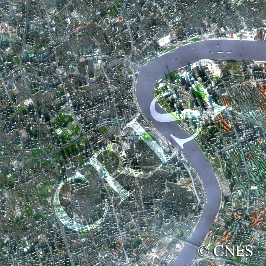
Note: The area of coverage in this SPOT-5 image is approximately 6.25 km x 6.25 km.
The reduced resolution image on display has undergone compression and so does not represent the true resolution of the original satellite image.
The swinging Huangpu River flows north to the Yangtze with the city of Shanghai on its left bank and the newly developed Pudong on its right. The Suzhou Creek passes under a number of bridges to join the Huangpu from the west. The triangular green Huangpu Park is located south of the confluence, with the famous Bund extending along the Huangpu southwards, flanked by historic buildings. Further south and southwest are the brown roofs of the low-rise houses of old Shanghai. Towards the southern margin of the image, the Nanpu Bridge crosses the river. In the middle of the image is the green Renmin Square with impressive buildings such as the Shanghai Museum, encircled by highways. In the low winter sun, the shadows of the very tall buildings of Pudong have fallen across the image, the Oriental Pearl Tower being the easiest to recognize. The green and red roofs of the newly-built Pudong are distinctive; as is the wide Century Avenue running southeast from the Pearl Tower. A number of vessels are travelling on the Huangpu; the bigger ships are moored downstream.