The Brahmaputra River In The Dry Season, Assam, India
28 February 2009
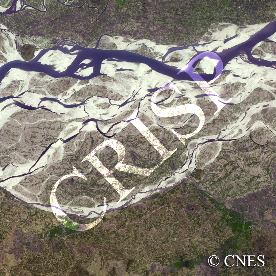
Note: The area of coverage in this SPOT-5 image is approximately 25 km x 25 km.
The reduced resolution image on display has undergone compression and so does not represent the true resolution of the original satellite image.
The water stage is falling in the Brahmaputra, flowing towards the west. The river, which flows 10-15 km wide in the wet monsoon, has returned to its main channel in dry February. The other channels of this huge braided river, choked with sand that was being transported when the river was high, are now separated by wet season alluvial bars. The tops of the bars are farmed, the fields running orthogonal to the long axis of the bars. A small hill acts as a control on the right bank of the river near the western margin of the image. The relief on the floodplain beyond the braided channels is created primarily by small overflow channels of the Brahmaputra and its tributaries. Farming is less intensive in the southern wetlands, although almost everywhere the fields are bare.