Container Park, Port Of Surabaya, East Java, Indonesia
22 June 2009
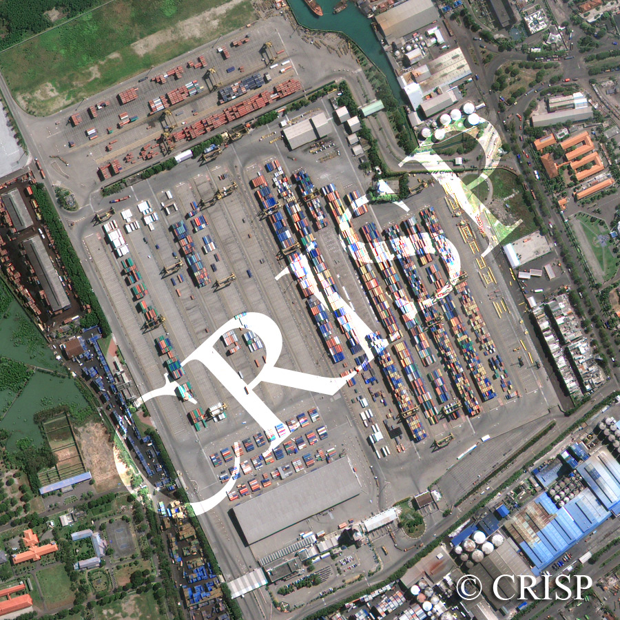
Note: The area of coverage in this GEOEYE-1 image is approximately 1 km x 1 km.
The reduced resolution image on display has undergone compression and so does not represent the true resolution of the original satellite image.
This high-resolution satellite shows the container park and surrounding areas of the modern port of Surabaya. Small and large brightly coloured containers are systematically parked. The container park is connected via a conveyor belt with a pier towards the northwest, beyond this image, where containers are loaded into and unloaded from ships. Other port facilities include storage tanks and sheds; a number of the sheds have bright blue roofs. The eastern side of the image shows cars and trucks moving along a landscaped road system. The southwestern corner also shows planned development with new buildings surrounded by lawns, hedges, planted trees and a basketball court. This section of the port replaces a mangrove swamp, part of which still persists.