Edge Of The Tengger Caldera, Cemoro Lawang, Java, Indonesia
21 August 2009
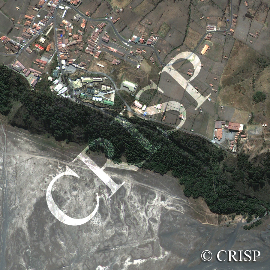
Note: The area of coverage in this GEOEYE-1 image is approximately 0.77 km x 0.74 km.
The reduced resolution image on display has undergone compression and so does not represent the true resolution of the original satellite image.
This is a high-resolution portrayal of the edge of the Tengger caldera in east Java, displaying an upper surface on which the town of Cemoro Lawang stands, a steep escarpment that marks the crater rim, and part of the crater floor. The spectacular old caldera of Tengger is part of the Bromo-Tengger-Semuru National Park. A very popular early morning walk starts from Cemoro Lawang and traverses the sand sea of the crater to see the sunrise over the volcanic peak of Bromo, located beyond this image. The town with various-hued roofs in a range of styles is perched at the edge of the crater rim, connected by roads leading northwards to Probolinggo on the north coast of Java. The buildings are concentrated near the rim and along the road towards the northwest, avoiding low hills created by past volcanic eruptions. The distinct shadow of a telecommunication tower falls across some of the roofs towards the northwest. The escarpment forming the crater rim is heavily vegetated with tall trees, through which steep paths lead down to the crater floor. The ash-coloured floor of the crater displays the white paths that traverse the base of the escarpment and lead southwards, dark humps marking earlier volcanic eruptions, and signs of recent erosion by water running down the escarpment.