Olongapo City, Subic Bay, Luzon, Philippines
17 November 2008
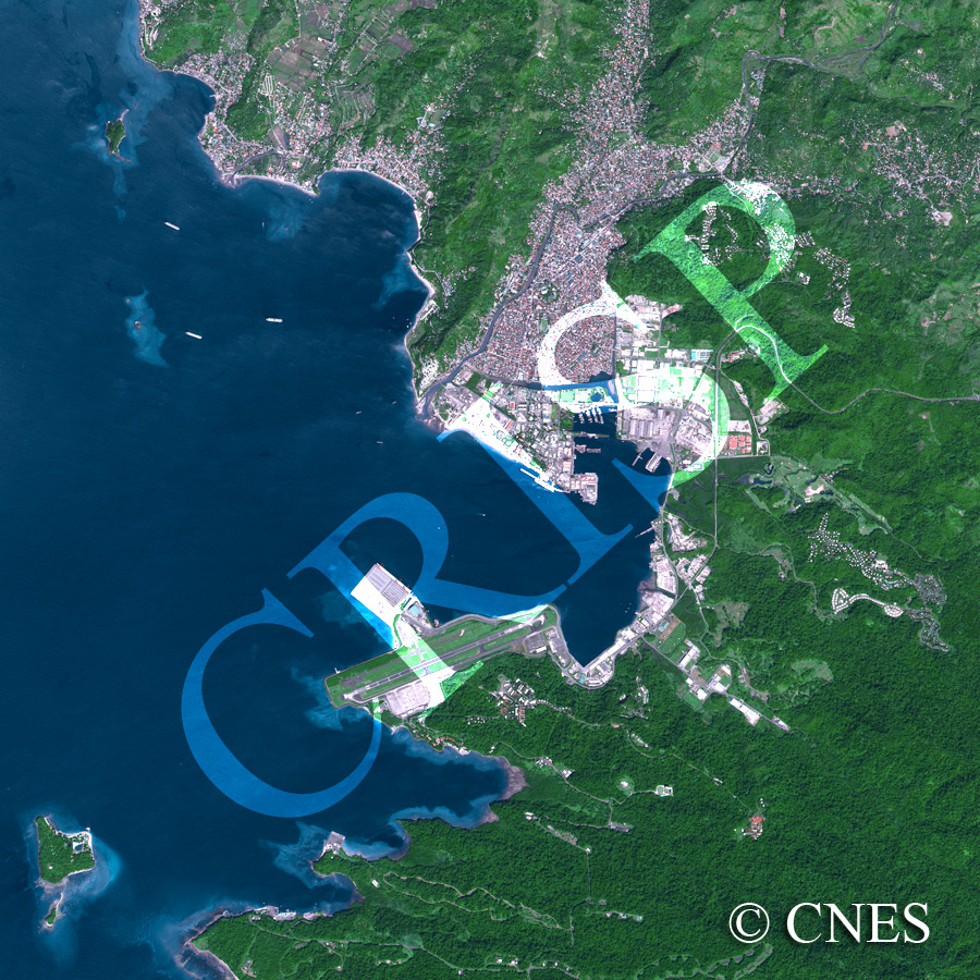
Note: The area of coverage in this SPOT-5 image is approximately 12.5 km x 12.5 km.
The reduced resolution image on display has undergone compression and so does not represent the true resolution of the original satellite image.
This is part of the western Luzon coast, in and around Subic Bay. The northeast-southwest running alternate ridges and valleys have given rise to a beautiful coastline with offshore islands, headlands, curved bays and well-developed beaches. Small rivers drain the valleys, bringing in sediment to form subdued deltas on the coast. Coastal settlements have spread inland, up these valleys. Olongapo City, located at the centre of the image with well-developed port and recreational facilities, is the best example. Subic Bay used to be a large U.S. naval base. This is reflected in the large airport and harbour facilities, part of which has recently been modified to create the Subic Bay Freeport Zone with its tourist facilities. The urban development remains concentrated along the northern valleys, while forested hills mark the southeastern corner.