Tropical Cyclone Nargis, Ayeyarwady Delta, Myanmar
7 May 2008
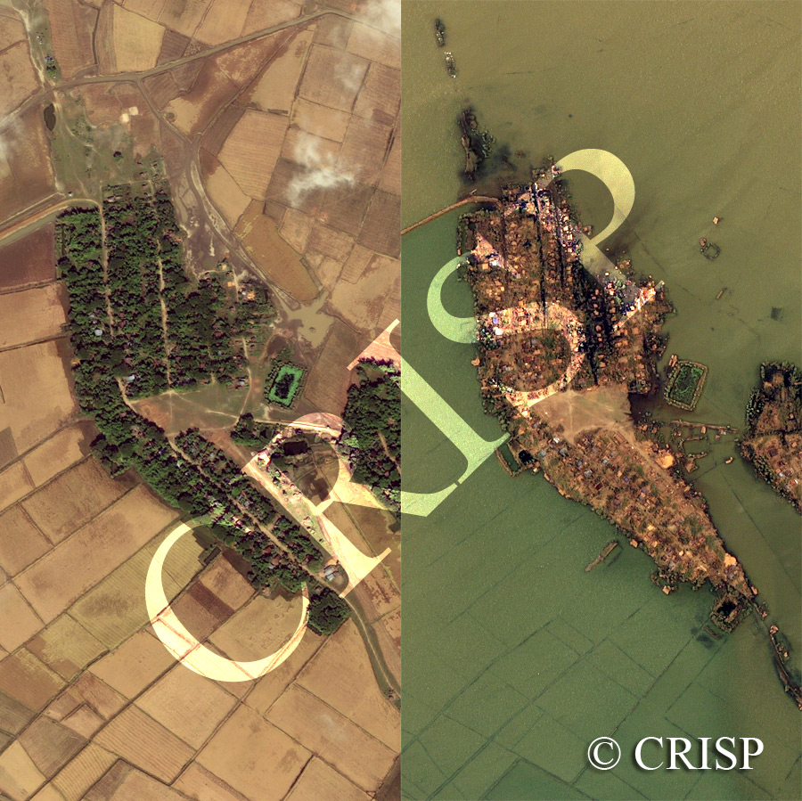
Note: The area of coverage in this IKONOS image is approximately 0.62 km x 1.24 km.
The reduced resolution image on display has undergone compression and so does not represent the true resolution of the original satellite image.
The right image shows damage and inundation from tropical cyclone Nargis, five days after the disaster. The left image is that of the same scene on 14 December 2002 for comparison. Nargis, one of the most disastrous tropical cyclones, started to develop on 27 April 2008 in the Bay of Bengal, reached tropical cyclone status on 2 May 2008, turned east, and crossed the low delta of the Ayeyarwady River with disastrous consequences. The images are located south of Yangon, near the coast close to Ale-ywa. The village imaged was located in relatively high ground, with a number of houses under large shady trees, the surrounding lowland under paddy. After Nargis, the trees have disappeared, exposing a destroyed village. The paddy fields are under salt water, only patches of high ground partly escaping the calamity.