Mount Merapi Erupting, Java, Indonesia
16 June 2006
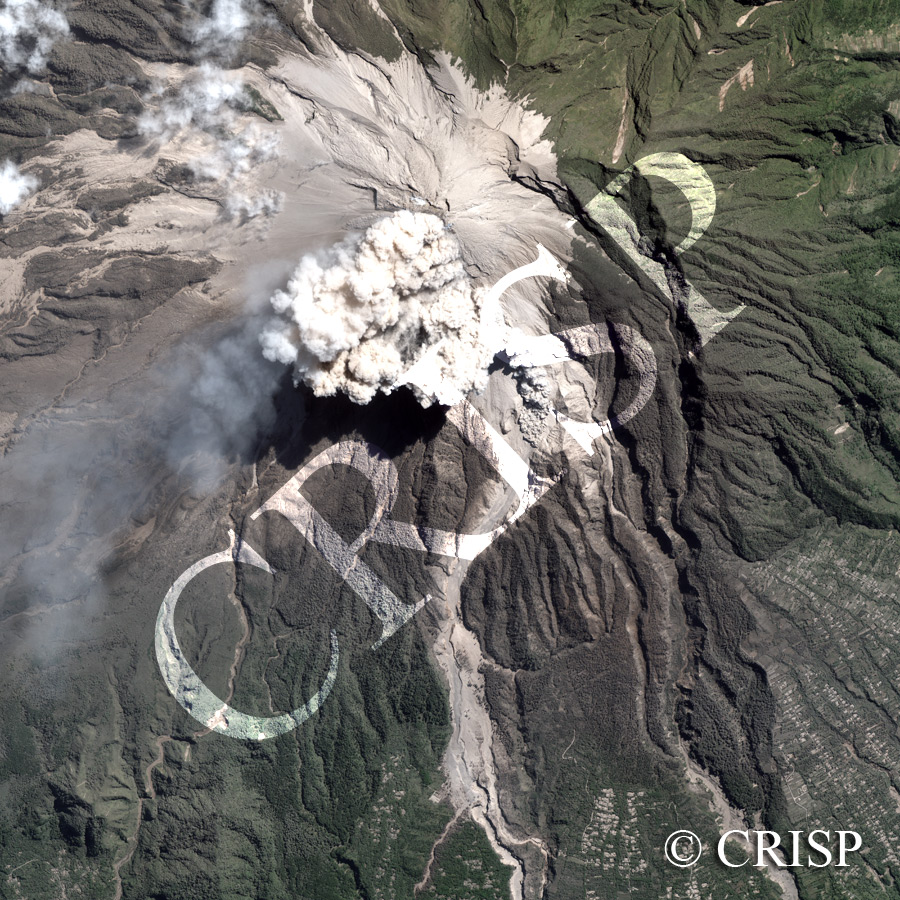
Note: The area of coverage in this IKONOS image is approximately 6.5 km x 6.5 km.
The reduced resolution image on display has undergone compression and so does not represent the true resolution of the original satellite image.
Mount Merapi in central Java erupted several times in June 2006. This image of the 16 June caught a pyroclastic flow emerging from below a coignimbrite ash cloud. This probably is the first satellite image of a pyroclastic flow, a very short-lived phenomenon, usually lasting only minutes. Details of this flow have been published in Eos, Transactions, American Geophysical Union, 27 May 2008. The 0.5 km long and 0.25-0.5 km wide pyroclastic flow travelled down the southern face of the Merapi along the upper Gendol River valley and crossed a ridge created by the deposits of an earlier flow that reached as far as 6 km downvalley. Villages and agricultural fields on the lower slopes of the volcano are periodically threatened by such flows.