Gunung Agung, Bali, Indonesia
22 May 2007
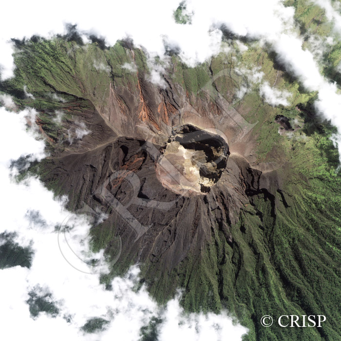
Note: The area of coverage in this IKONOS image is approximately 4.35 km x 4.35 km.
The reduced resolution image on display has undergone compression and so does not represent the true resolution of the original satellite image.
The sacred Mount Agung, a 3142 m high stratovolcano, dominates the landscape of eastern Bali. It last erupted in 1963, breaking a period of dormancy that had lasted for 120 years. A number of lahars completely remodelled the local landscape and over a thousand people were killed by the eruption, which immediately followed the important Eka Dasa Rudra ceremony at various temples on the lower slopes. The steep upper slopes of Gunung Agung, created by lahars and pyroclastic flows, rise above the clouds that often surround the midslopes of this volcano. The rectangular shape of the crater suggests faulting on a local scale, and wall collapses, screes from slope failures, and large volcanic blocks are visible inside the crater. Hot pyroclastic flows and lahars are active on the western and southwestern slopes of the volcano, descending through the lightly-vegetated lahar-created valleys. Vegetation is re-establishing itself on the volcanic slopes, and a canopy of trees cover the southeast, presumably being less affected in the last eruption.