Head Of The Mahanadi Delta, Orissa, India
1 January 2007
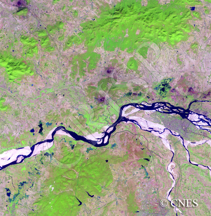
Note: The area of coverage in this SPOT-4 image is approximately 45 km x 45 km.
The reduced resolution image on display has undergone compression and so does not represent the true resolution of the original satellite image.
The image shows the lower part of the Mahanadi, a 850 km long river that flows east through the northern part of Indian Peninsula to the Bay of Bengal. Huge sand bars and islands are exposed in the channel of this seasonal river, low in winter. The sand bars are at different levels, and elongated pools of water have been trapped locally. The floodprone nature of the Mahanadi is displayed in the shape of the bars and the pattern of past flow marks across them. The head of the delta starts near the centre of the image with the river dividing into a number of distributaries flowing east. Cuttack, the largest city in Orissa, is situated between the two large northern distributaries and Bhubaneswar, the capital of the state of Orissa, lies next to the westernmost channel that flows due south. In winter the hills are green but a major part of the lower croplands is bare, and the need for water is reflected in the number of small reservoirs that dot the lower slopes of small hills towards the south.