Kuantan, Pahang, Malaysia
20 July 2006
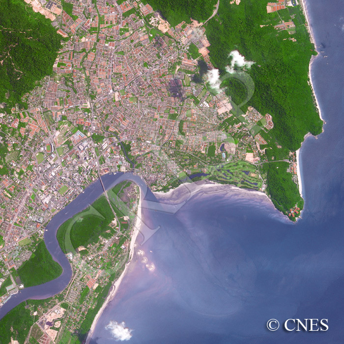
Note: The area of coverage in this SPOT-5 image is approximately 7.5 km x 7.5 km.
The reduced resolution image on display has undergone compression and so does not represent the true resolution of the original satellite image.
The image shows the transition of the once quiet Kuantan on the east coast of the Malay Peninsula to a more bustling urban centre. An old settlement, Kampung Tanjung Lumpur is located at the top of the peninsula, resembling the head of a turtle, round which the sediment-bearing Kuantan River flows to the South China Sea. The bridge over the Kuantan River carries the major road along Malaysia’s east coast. Kuantan is expanding from the coast along a valley that stretches northwest between parallel hills. Green space is still left next to the river and on the hills, one of which forms a line of steep cliffs along the coast. A line of J-shaped beaches occur at the base of the coastal cliff. Teluk Chempedak, the famous beach of Kuantan is the southernmost one. Hotels near the beach and on the neighbouring headland, and a golf course behind it, provide the impression of Kuantan as a tourist resort.