Ha Long Bay, Vietnam
31 January 2007
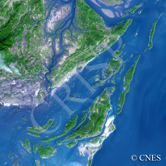
Note: The area of coverage in this SPOT-4 image is approximately 48 km x 48 km.
The reduced resolution image on display has undergone compression and so does not represent the true resolution of the original satellite image.
This image covers the northeastern part of the spectacular Ha Long Bay off the Gulf of Tonkin. Innumerable limestone islands of a wide range of sizes with cliffs, grottos and other striking physical features have made this northeastern corner of Vietnamese coast famous and a tourist attraction. The curved spiny islands have also given rise to the legend of a dragon-created landscape. A number of excellent small beaches nestle in sheltered spots among the islands. Towards the north, one of the channels of the Red River Delta system appears with a number of tidal creeks and sand islands. The mainland consists of limestone hills, like the islands, with small patches of cleared areas and some agricultural fields next to the creeks. Plumes of two anthropogenic fires blow westward in the coastal breeze and part of the harbour of Hóng Gai is visible towards the west.