National University Of Singapore, Kent Ridge, Singapore
7 May 2007
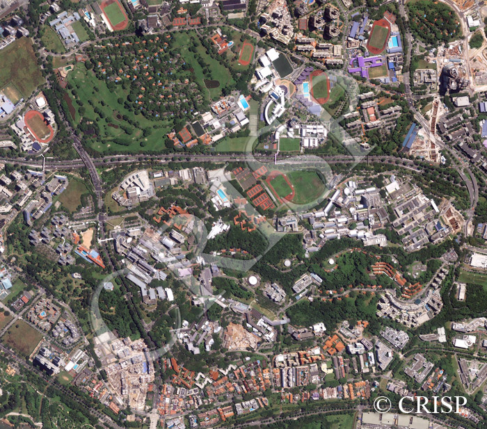
Note: The area of coverage in this IKONOS image is approximately 2.49 km x 2.16 km.
The reduced resolution image on display has undergone compression and so does not represent the true resolution of the original satellite image.
The current Kent Ridge Campus of the National University of Singapore is located between the Ayer Rajah Expressway, which runs diagonally through the middle of the image, and Clementi Road towards the west. The wooded Kent Ridge Hill, site of a major battle in 1942, runs through the middle of the campus. The Administration Building with its raised circular roof tower can be seen immediately south of the playing fields, where there are tennis courts, football and cricket pitches and the University’s Olympic swimming pool. The teaching buildings are usually in white and grey. The older student accommodation is marked by red roofs, while the newer student hostels, located mostly towards the south of the image, carry a different architectural design. The largest circular white structure on the south slope of Kent Ridge is the Singapore Synchrotron Light Source research facility. The newly completed cultural complex is located in the triangular piece of land where the two major roads converge. The University’s teaching hospital is at the other end of the campus. In future, the University will expand north replacing the golf course. A large overhead bridge will allow easy communication across the expressway. The NUS High School of Mathematics and Science can be seen in the extreme northwestern corner of the image. Various other educational institutions are also located north of the image beyond the expressway.