Border Between China And North Korea
29 October 2006
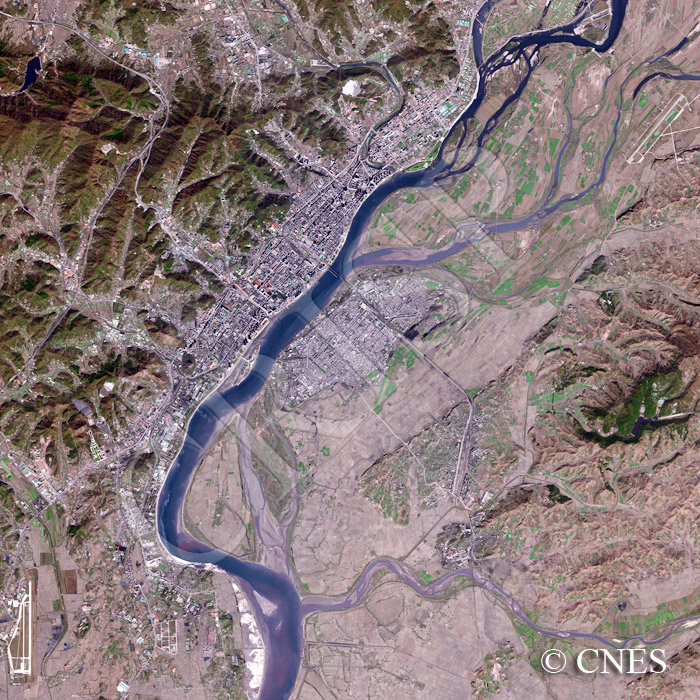
Note: The area of coverage in this SPOT-5 image is approximately 20 km x 20 km.
The reduced resolution image on display has undergone compression and so does not represent the true resolution of the original satellite image.
The Yalu River marks the border between China to the west and North Korea to the east. The Chinese city of Dandong on the river is backed by a range of hills with forested slopes and busy transport arteries running through narrow valleys along which fingers of urbanization have spread. The Sino-Korean Friendship Bridge connects Dandong with the smaller city of Sinuiju on the other bank. Next to it is the remnant of a half-destroyed bridge. Farms and fields occur on the lowland on both sides but the general barrenness of the North Korean hills contributes a desolate appearance to the eastern part of the image. Presumably as a result, the Yalu is transporting a large volume of sediment. Two airports, one serving each of the two cities, mark the corners of this green and grey landscape.