Gunung Rinjani, Lombok, Indonesia
28 August 2007
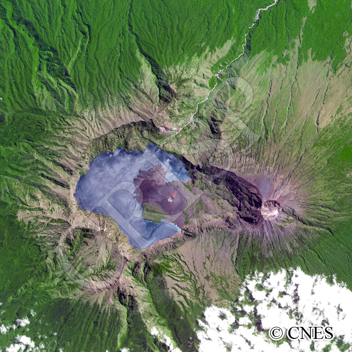
Note: The area of coverage in this SPOT-5 image is approximately 15 km x 15 km.
The reduced resolution image on display has undergone compression and so does not represent the true resolution of the original satellite image.
The 3626 m high, steeply rising Rinjani volcano broods over north Lombok, Nusa Tenggara. A dark blue lake identified as the daughter of the sea, Danau Segera Anak, fills part of the crater at 2000 m above sea level. A new active crater, appropriately known as Mount Baru (new), is rising from the lake. Mount Baru last erupted in 2004. The crater of the Rinjani is stretched east-west along a fault, the crossing of which with another fault has determined the location of Mount Baru. The nearly straight and deep Putih Valley to the north probably follows this second fault. The present appearance of Rinjani is due to both tectonic activities and collapse of the caldera from past paroxysmic eruptions. The volcano is recognized as sacred and the water of the lake is considered to have healing properties, leading to regular religious ceremonies and offerings.