Korat Plateau Near Udon Thani, Thailand
26 December 2004
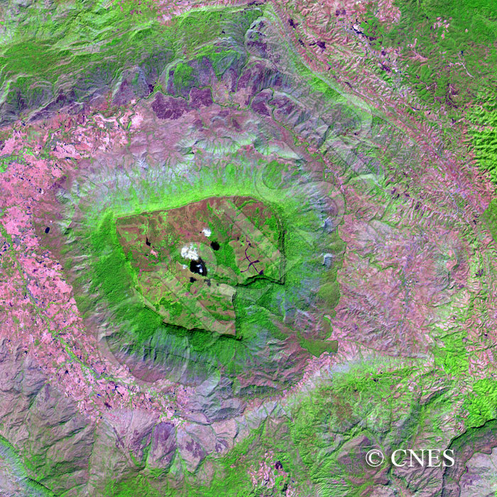
Note: The area of coverage in this SPOT-4 image is approximately 30 km x 30 km.
The reduced resolution image on display has undergone compression and so does not represent the true resolution of the original satellite image.
This image is rotated 180º, with the north towards the bottom, for better three-dimensional viewing. The landscape has resulted from stream erosion on uniclinal geological structure with low gradient beds. This has given rise to a series of steps ending in a small plateau-like structure in the middle, with steeper slopes towards the northeast and gentler ones towards the southwest. Streams that rise near the far edge of the heart-shaped central highland join to form a single channel that descends steeply, creating an eroded escarpment. The stream then joins a drainage system that circumvents the central mesa. In this dry and rocky region, vegetation is found along the river channels and also on the scree slopes below the escarpment. A number of small blue ponds dot the landscape to the left of the image, and water management features are also seen on top of the central plateau.