Port Klang, West Malaysia
16 March 2005
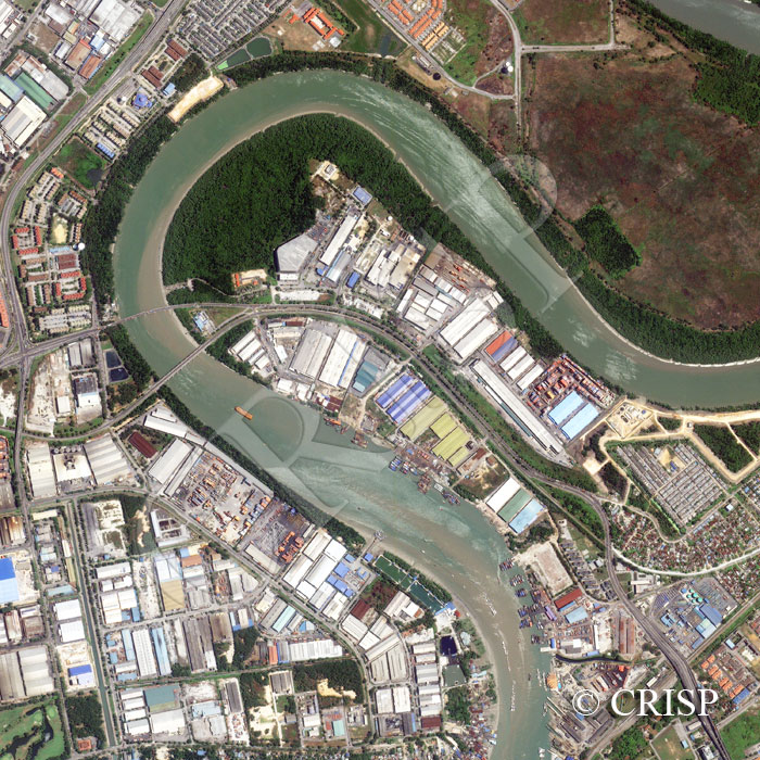
Note: The area of coverage in this IKONOS image is approximately 3 km x 3 km.
The reduced resolution image on display has undergone compression and so does not represent the true resolution of the original satellite image.
This high-resolution image, dominated by a bend of the River Kelang, displays the transformation of a coastal wetland into a modern seaport for Kuala Lumpur. The image shows a mosaic of the remnants of a former wetland, cleared ground, elevated highways, new housing, a golf course, and modern port facilities. The functions of the port as cargo and ferry terminals are clearly demonstrated in the types of vessels in the river, docking facilities, stacked containers, and colourful roofs of storage sheds and associated buildings including a set of turquoise storage tanks towards the southeast. Even individual vehicles and roadside trees are visible on the busy highways.