Tsunami Destruction, Aceh Coast, Sumatra, Indonesia
Note: The area of coverage in this IKONOS image is approximately 1.432 km x 1.432 km.
The reduced resolution image on display has undergone compression and so does not represent the true resolution of the original satellite image.
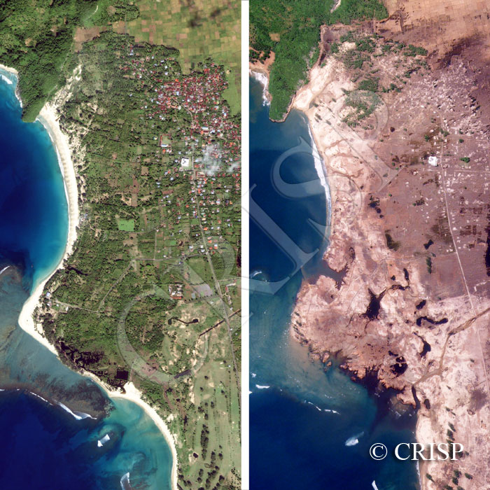
This pair of images map the devastation caused by the huge tsunami from the earthquake of 26 December 2004 near Meuseugit, south of Bandar Aceh. The image to the left is for 13 January 2003, and the one to the right is for 29 December 2004, three days after the tsunami. The height of the tsunami in this location is marked by the trim line on the northwestern headland, a former volcanic flow. The beach has been eroded along with the entire landscape at the head of the bay including houses, planted trees, and paddy fields. After three days, sediment eroded from the land is still identifiable offshore. The former water bodies on land have been enlarged and new ones created. The large and well-constructed mosque is the sole building that survives, only the foundations of the other buildings can be recognised indistinctly, along with the roads. Loss of life has been horrifying.