The Ganga River, North India
26 April 2005
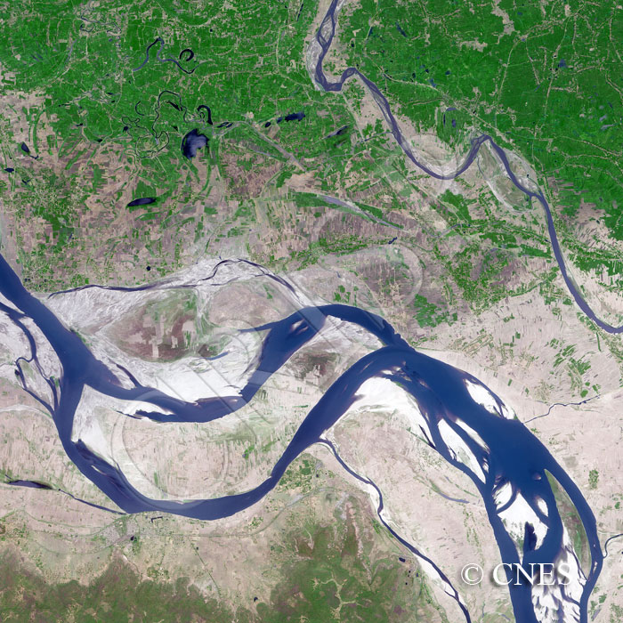
Note: The area of coverage in this SPOT-5 image is approximately 25 km x 25 km.
The reduced resolution image on display has undergone compression and so does not represent the true resolution of the original satellite image.
The Ganga (Ganges), shown here in the dry season, flows through an alluvial plain. Its very large bar systems demonstrate the huge amount of the sediment that this river transports. New sediment is forming low level bars below vertical rises to the top of old high bars, the upper surface of which is farmed. The volume of the sediment stored is clearly visible towards the southwest, where the bars rise vertically from narrow abandoned channels that still carry water. Paddy fields to the north of the present channel demarcate the past position of this big river and the alignment of the fields indicates the geometry of the channel before shifting. Further north, narrower channel fragments and lakes indicate the former locations of tributaries that were forced to move southeast like the one in the image before joining the main river. In the dry season, land is farmed near these abandoned courses.