Fire And Plantations, East Sumatra, Indonesia
11 August 2005
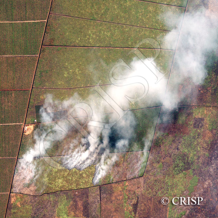
Note: The area of coverage in this IKONOS image is approximately 2 km x 2 km.
The reduced resolution image on display has undergone compression and so does not represent the true resolution of the original satellite image.
In early August 2005, large areas under vegetation were burnt in the coastal areas of eastern Sumatra, creating intense air pollution on both sides of the Malacca Strait and a hazardous situation over the Kuala Lumpur region. This image shows details of such burning in the Bagansiapiapi area in the coastal plain of east Sumatra. The area of oil palm plantation is marked by the geometric pattern of lined trees, deep ditches with narrow bridges for crossing them, unpaved roads, and small buildings set in cleared yards. Fire has been set in the scrubland next to the oil palm trees, in an area that already has parallel-running ditches. The curved front of the fire towards the south of the image is clearly visible. Another fire, much smaller in size, has started towards the southwestern corner. The smoke from the fire is travelling northeast in the ambient wind towards the Malacca Strait.