The Chin Hills And The Chindwin River, West Myanmar
16 March 2005
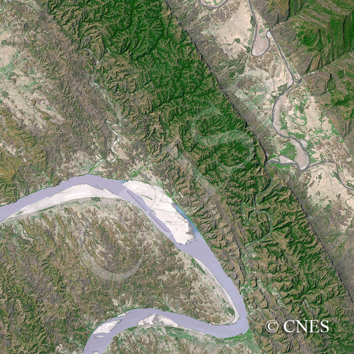
Note: The area of coverage in this SPOT-5 image is approximately 15 km x 15 km.
The reduced resolution image on display has undergone compression and so does not represent the true resolution of the original satellite image.
This image has been rotated with the north towards the bottom to facilitate better three-dimensional viewing. The parallel belts of hard and soft rocks in the Chin Hills have given rise to alternating bands of hills and valleys. The drainage pattern is strongly structure-guided. The meandering Chindwin displays a series of point and eddy bars in sand, the edges of which are sharply delineated by a low water level in the dry season. Towards the right, a river with elongated meanders, carrying dark-coloured fine-grained sediment, is confined in a valley. Its tributaries erode steeply through the hills to join it at right angles. It finally flows into the Chindwin, cutting spectacularly across a range of hills. The hills are partly forested, and there are signs of habitation being limited to valleys, especially along the Chindwin.