North Slope Of The Kunlun Mountains, Xinjiang, China
25 October 2004
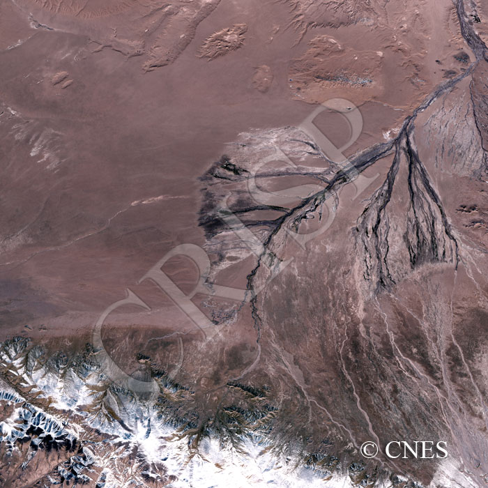
Note: The area of coverage in this SPOT-5 image is approximately 40 km x 40 km.
The reduced resolution image on display has undergone compression and so does not represent the true resolution of the original satellite image.
A number of nearly dry drainage lines radiate northeast from the snow covered, steep-sided and deeply dissected Arkatag, the highest range of the Kunlun Mountains. Beyond the piedmont fans, the drainage channels converge and erode the soft material of the basin in this dry landscape, giving rise to an anastomosed pattern. Sand dunes occur towards north on the floor of the basin. The channels circumvent the dunes to flow into a bigger river that is part of the drainage to the Ayakkum Lake at the centre of the basin, beyond the area covered by the image.