Farming Near Bangkok, Thailand
11 February 2004
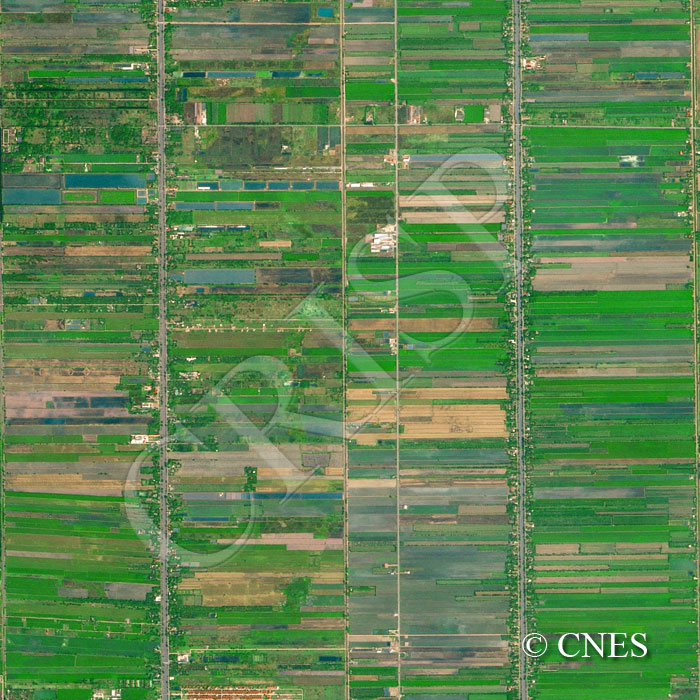
Note: The area of coverage in this SPOT-5 image is approximately 5.003 km x 5.000 km.
The reduced resolution image on display has undergone compression and so does not represent the true resolution of the original satellite image.
This mosaic of green agricultural fields growing rice and a mixture of other crops in irrigated flat land is representative of a large area northeast of Bangkok. The roads, and the tree-flanked canals tend to run almost directly north-south, whereas the narrow, elongated crop fields are aligned east-west. This makes it easy to access a road or a canal from the fields. The geometric design of the image is heightened also by the varying colour of the fields that range from bare ground through a variety of crops in different hues and textures to small areas of trees and shrubs.