Yangtze Below Poyang Lake, China
6 March 2004
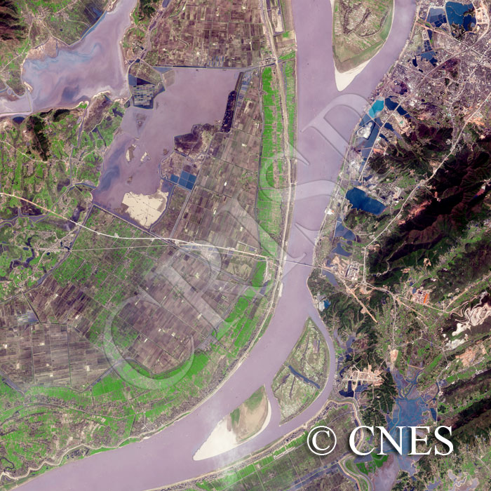
Note: The area of coverage in this SPOT-5 image is approximately 20 km x 20 km.
The reduced resolution image on display has undergone compression and so does not represent the true resolution of the original satellite image.
The Yangtze here flows south to north through a low land with a number of shallow lakes. The two banks are in striking contrast. The western side is entirely rural with innumerable rice fields, shallow wetlands and small settlements. The eastern side is mainly hilly, with several towns and a road network. Where the hills are closest, the channel is narrow and spanned by a high bridge. In the Yangtze there are large islands with fresh sand on the upstream side and abandoned channels on top. The flat plains, and the sudden narrowing of the channel, suggest occasional flooding in this part of the Yangtze lowlands.