Summit Of Gunung Kinabalu, Sabah, Malaysia
18 February 2003
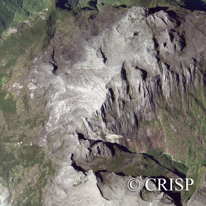
Note: The area of coverage in this IKONOS image is approximately 3.50 km x 3.50 km.
The reduced resolution image on display has undergone compression and so does not represent the true resolution of the original satellite image.
The granitic pluton of Kinabalu (at about 6º N) was under ice during the Pleistocene, resulting in a bare mountain top with glaciated striations, sharp peaks, near-vertical cliffs and deep valleys. The sun is bright on the peaks with hard shadows below the rock cliffs. The bright patch in the centre is an area of flat rock with the peak of Ugly Sister on the skyline to its north and the summit, Low’s Peak (4101m), a little to the northwest. The small pair of shadows to the southeast of Ugly Sister are of sharp rock protrusions known as Donkeys Ears. The glaciated valley of Low’s Gully drops rapidly towards the northeast. Below the bare rock is the remarkable mountain vegetation of Kinabalu, with the path to the summit climbing through it past several camping huts.