Log Rafts, West Kalimantan, Indonesia
24 June 2004
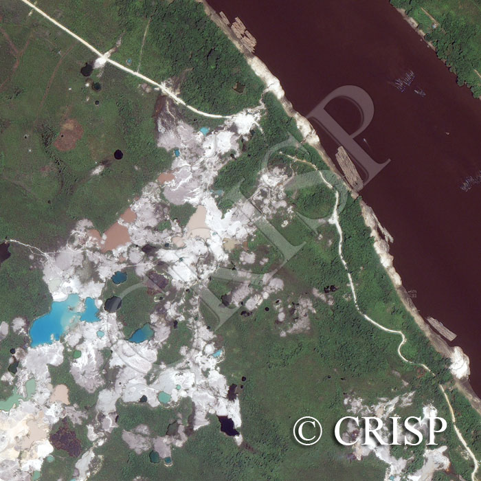
Note: The area of coverage in this IKONOS image is approximately 1.33 km x 1.33 km.
The reduced resolution image on display has undergone compression and so does not represent the true resolution of the original satellite image.
The image is a land use mosaic, displaying low vegetation, recently burnt patches and previously deforested land in the Kapuas River Basin in western Kalimantan. Water has accumulated in the hollows of cleared ground giving rise to pools of different colours. The brightness of the road next to the river, the accumulation of patches of alluvium with bright reflectance and smooth texture on riverbank, and the reddish tint of the cleared land suggest advanced chemical weathering with clay formation. The banks of the river are high, steep, and unvegetated, indicating high flows at intervals. Rafts of large logs are tied to the riverbank prior to travelling downriver.