Ho Chi Minh City, Vietnam
18 February 2004
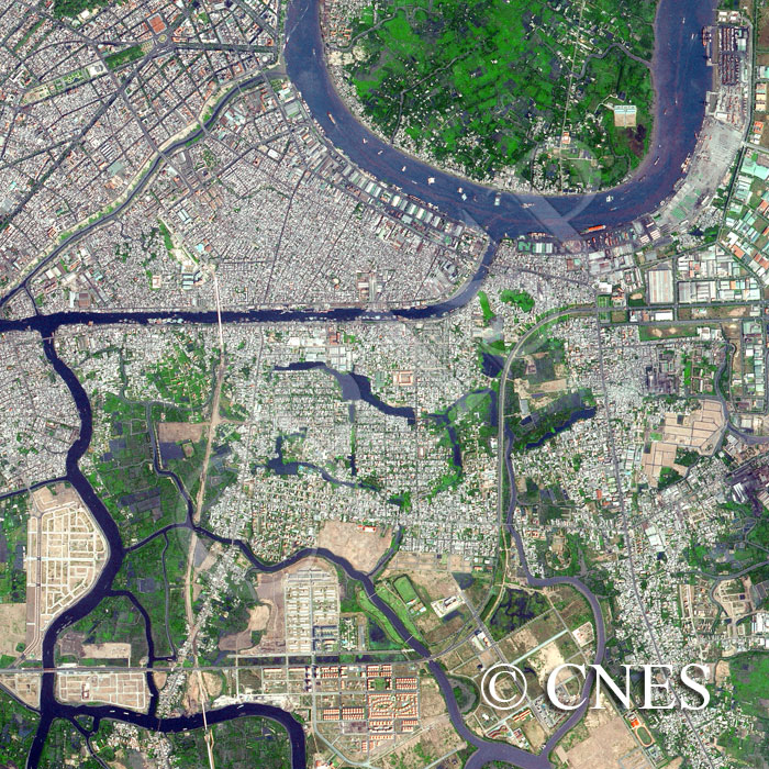
Note: The area of coverage in this SPOT-5 image is approximately 5.85 km x 5.85 km.
The reduced resolution image on display has undergone compression and so does not represent the true resolution of the original satellite image.
The image stretches south from the city centre to the rural district of Nha Bè, illustrating the ongoing spread of the city. To the north, beyond the bend in the Saigon River, with its heavy boat traffic lies open green space. The diagonally-flowing watercourse is the Ben Nghe channel with the Ho Chi Minh Museum located on the southern side of its confluence with the Saigon River. Rows of warehouses and jetties are seen on the right bank of the Saigon River and the densely-built District 4 behind it contrasts with District 1 ( Saigon) on the other side of the Ben Nghe. The green patches to the northwest are part of the Saigon Commercial Centre and a corner of the Cong Vien Van Hoa Park.