Land Development, East Sumatra, Indonesia
28 June 2004
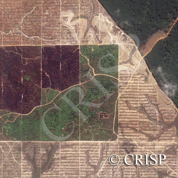
Note: The area of coverage in this IKONOS image is approximately 1.86 km x 1.86 km.
The reduced resolution image on display has undergone compression and so does not represent the true resolution of the original satellite image.
The image illustrates land development in eastern Sumatra, northwest of Pekanbaru. The original vegetation survives in the northeastern corner, where the edge of the cleared patch and the red road suggest the density and height of trees. The sharp boundary of cleared land next to the forest, the geometry of a number of lines, and the contoured paths round the small hills indicate an early stage of land development. The dark patch towards the west is an area of recently burnt vegetation. Secondary vegetation has been allowed to grow in the green area between the burnt patch and the cleared land. Gullies are visible on the cleared land, eroding headwards towards the relatively high centre of the image.