Chindwin River, Central Myanmar
30 April 2004
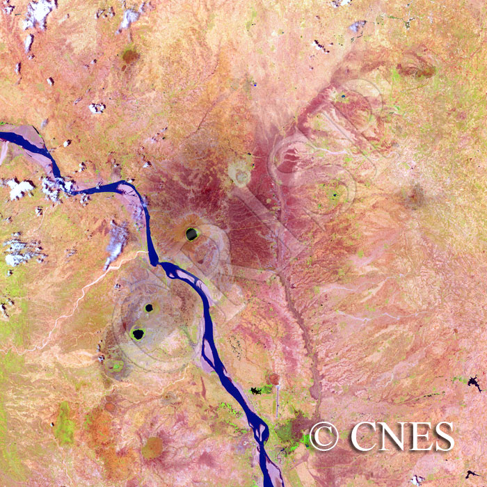
Note: The area of coverage in this SPOT-4 image is approximately 44.02 km x 44.02 km.
The reduced resolution image on display has undergone compression and so does not represent the true resolution of the original satellite image.
The northwest-southeast flowing Chindwin cuts across a line of dead volcanic cones. The straight segments connected at very high angles indicate structural control on the river. The Chindwin narrows strikingly as it approaches the cones. Upstream from this narrowing, the gradient steepens in the Chindwin and sediment does not accumulate in this reach. Downstream, the gradient slackens and sediment is dropped to build both point and midchannel bars. Eddy bars are also seen in places. In the dry season the land is bare, the smaller streams are dry, and the need for water is reflected in three reservoirs towards the southeastern corner, where an urban settlement can be seen with an airstrip and a bridge over the river.