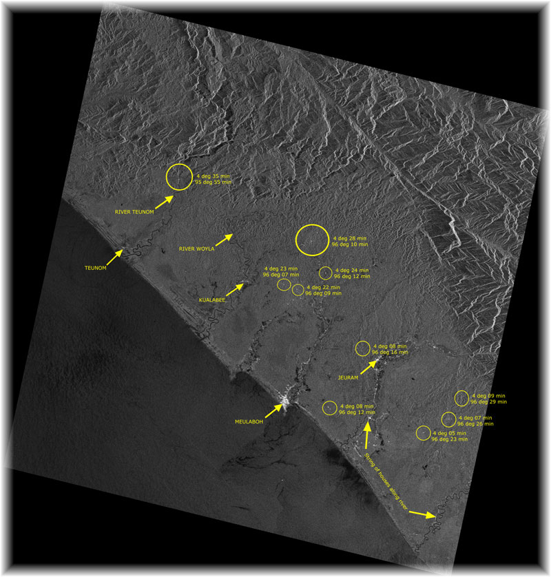
Aceh, Sumatra, Indonesia
6 January 2005
ERS Image © ESA 2005

120 km x 125.76 km
This is a Microwave image taken by the ERS satellite (owned by the European Space Agency). It has an active sensor that emits cloud-penetrating microwave and measures the reflection. Unlike optical satellites that rely on sunlight, this microwave satellite is able to collect imagery day and night. In this image, man-made structures in Meulaboh town such as houses reflected the microwave strongly due to corner-reflection. Hence, the Meulaboh town appears bright. The bright lines along two of the rivers are probably due to reflection from rows of houses. There are also isolated bright spots in the image. This might indicate smaller villages (indicated with Latitude and Longitude). On the northeast side of Meulaboh, strong reflections from the hills and mountain could also be observed
