Centre for Remote Imaging, Sensing and Processing
Mudflow in East Java, Indonesia (Introduction and sitemap) >> GeoEye 1 image on 31 May 2010
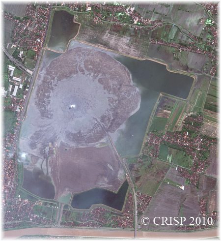 |
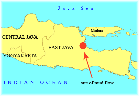
The satellite images in this page show the area that is affected by the mud flow that started in May 2006. The images shown were taken on 31 May 2010. Image size : approx. 3.705 km x 4.036 km |
( * Navigation short-cut for the image below : left click and drag image to navigate or drag red box in preview window)
Image Copyright : © CRISP 2010; usage of satellite images on CRISP web pages is subjected to terms and conditions.
Post a comment / message for the images shown. Your comment / message will be reviewed and considered for posting on our webpage. Email addresses submitted will not be displayed at our site. Email address submitted enable us to alert you if others see your comments and have questions for you. Thank you.