Overview of CRISP
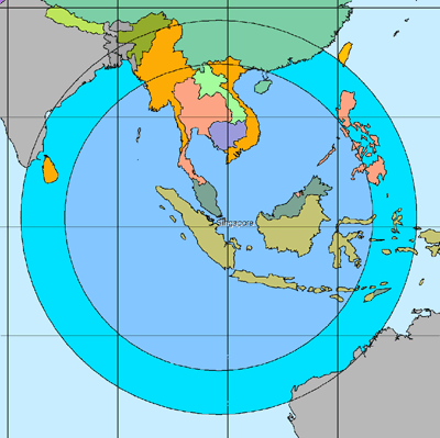
CRISP's remote sensing satellite ground station is one of the first multi-mission ground stations built around the open system concept, with a high level of flexibility to accommodate future satellite missions. It is able to acquire images of the earth's surface within a radius of about 3000km (for satellites orbiting at heights of about 800km) or 2300km (for satellites orbiting at heights of about 700km), covering the following countries:
- Brunei
- Indonesia
- Cambodia
- Laos
- Malaysia
- Myanmar
- Philippines
- Singapore
- Thailand
- Vietnam
- Sri Lanka
- The Southern Regions of China
CRISP is currently receiving and processing data from the following satellites:
- FENGYUN
- TERRA, AQUA and SUOMI-NPP
- WORLDVIEW-1 and WORLDVIEW-2
- CBERS 4
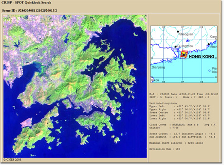
Users of remote sensing data can search the complete data catalogue of CRISP through internet. Quicklook images and location maps are provided together with textual information through the catalog-browse system.
Remote Sensing Products and Service
CRISP supplies standard and value-added products the conform to internationally accepted specifications, such as :
- SPOT: 1A, 1B, 2A, 2B, Pan+XS, SPOTView in SPOT DIMAP format.
- ERS: RAW, FDC, SLC, PRI in ESA CEOS format.
- RADARSAT: RAW, SLC, SGF, SGC, SSG, SCN, SCW in RADARSAT CEOS format.
Data can also be delivered in GeoTIFF or other standard formats which are ready for assimilation by GIS systems.
CRISP is able to supply special products such as large area mosaics, multiple-scene mosaics, DEM generated from stereo pairs, and interferometric products.
CRISP is prepared to provide training or consultation services in the fields of remote sensing technology or applications. CRISP welcome proposals from interested organisations to jointly develop applications of remote sensing data.

Research
CRISP conducts research in the processing, analysis and applications of satellite remote sensing data. The initial focus of CRISP's research was on Synthetic Aperture Radar (SAR) data processing, including interferometric SAR processing.
The research focus was then extended to the applications of SAR and optical data in ocean and coastal studies, and tropical vegetation studies. CRISP has also undertaken projects in environmental monitoring, such as the daily monitoring of the regional land/forest fires and monitoring of ocean oil pollution. Currently, CRISP's research is focused on the processing and applications of very high spatial resolution imagery, hyperspectral data, and multiple polarizations SAR in order to keep pace with the recent rapid developments in remote sensing technology.
CRISP has been active in forging strong linkages with the international remote sensing research community. Scientists from CRISP are principal investigators of projects funded by the National Space Development Agency (NASDA) of Japan. CRISP's scientists also participate as principal investigators in the NASA's EO-1 science team, and the ENVISAT projects of the European Space Agency (ESA).
CRISP's research effort has benefitted from its close collaboration with various operational and research organisations.
