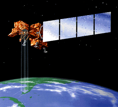
The LANDSAT program consists of a series of optical/infrared
remote sensing satellites for land observation. The program was first
started by The National Aeronautics and Space Administration (NASA) in 1972,
then turned over to the National Oceanic and Atmospheric Administration (NOAA)
after it became operational. Since 1984, satellite operation and data handling
were managed by a commercial company EOSAT. However, all data older than 2 years
return to "public domain" and are distributed by the Earth Resource Observation
System (EROS) Data Center of the US Geological Servey (USGS).
The first satellite in the series, LANDSAT-1 (initially named as the Earth
Resource Technology Satellite ERTS-1) was launched on 23 July 1972. The satellite
had a designed life expectancy of 1 year but it ceased operation only on January
1978. LANDSAT-2 was launched on 22 January 1975 and three additional LANDSAT
satellites were launched in 1978, 1982, and 1984 (LANDSAT-3, 4, and 5 respectively).
LANDSAT-6 was launched on October 1993 but the satellite failed to obtain orbit.
Currently, only LANDSAT-5 is operational. A new satellite LANDSAT-7 is scheduled
to be launched in late 1998.
LANDSAT-4, 5 Orbit
| Type | Sun-Synchronous |
| Altitude | 705 km |
| Inclination | 98.2 deg |
| Period | 99 min |
| Repeat Cycle | 16 days |
Sensors
- MSS (Multi-Spectral Scanner), on LANDSAT-1 to 5. Being one of the
older generation sensors, routine data acquisition for MSS was terminated
in late 1992. The resolution of the MSS sensor was approximately 80 m with
radiometric coverage in four spectral bands from the visible green to the
near-infrared (IR) wavelengths. Only the MSS sensor on Landsat 3 had a fifth
band in the thermal-IR.
LANDSAT 4,5 MSS Sensor Characteristics
| | Band | Wavelength (µm) | Resolution (m) |
|---|
| Green | 1 | 0.5 - 0.6 | 82 |
|---|
| Red | 2 | 0.6 - 0.7 | 82 |
|---|
| Near IR | 3 | 0.7 - 0.8 | 82 |
|---|
| Near IR | 4 | 0.8 - 1.1 | 82 |
|---|
- TM (Thematic Mapper), first operational on LANDSAT-4. TM sensors
primarily detect reflected radiation from the Earth surface in the visible
and near-infrared (IR) wavelengths, but the TM sensor provides more radiometric
information than the MSS sensor. The wavelength range for the TM sensor is
from the visible (blue), through the mid-IR, into the thermal-IR portion of
the electromagnetic spectrum. Sixteen detectors for the visible and mid-IR
wavelength bands in the TM sensor provide 16 scan lines on each active scan.
Four detectors for the thermal-IR band provide four scan lines on each active
scan. The TM sensor has a spatial resolution of 30 m for the visible, near-IR,
and mid-IR wavelengths and a spatial resolution of 120 m for the thermal-IR
band.
LANDSAT 4, 5 TM Sensor Characteristics
| | Band | Wavelength (µm) | Resolution (m) |
|---|
| Blue | 1 | 0.45 - 0.52 | 30 |
|---|
| Green | 2 | 0.52 - 0.60 | 30 |
|---|
| Red | 3 | 0.63 - 0.69 | 30 |
|---|
| Near IR | 4 | 0.76 - 0.90 | 30 |
|---|
| SWIR | 5 | 1.55 - 1.75 | 30 |
|---|
| Thermal IR | 6 | 10.40 - 12.50 | 120 |
|---|
| SWIR | 7 | 2.08 - 2.35 | 30 |
|---|
 Back to Main Index Back to Main Index
|


 LANDSAT, USA
 Back to Main Index