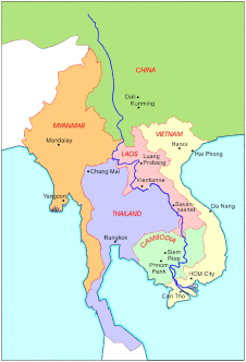
The Mekong Basin
Remote Sensing StudyUsing satellite imagery and digital image analysis techniques, scientists at the Centre for Remote Imaging, Sensing and Processing (CRISP), National University of Singapore, are examining the land cover change in the Middle Mekong Basin and its impacts on the river channels. The objective of the study is to demonstrate the application of remote sensing data and digital image processing techniques in the evaluation of environmental changes in a large river system.Study Area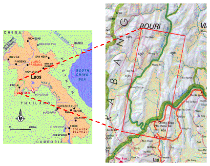 The study area covers the upland part of the Mekong Basin. This is an area of structurally controlled ridges and valleys with steep slopes. The main rainy season is the southwestern monsoon period from May to October. About 80% of the Mekong river's discharge comes between June and November. MethodsData setThe dataset used for this study were a pair of SPOT panchromatic images acquired on Nov 26-27, 1997 for digital elevation model (DEM) extraction, and SPOT multispectral images acquired on Jan 8, 1996 and Feb 18, 1998 for change detection.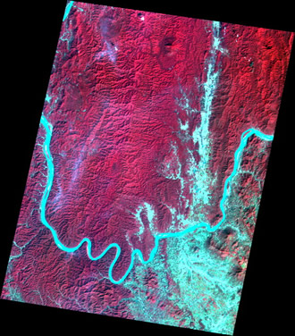
SPOT image of the study area acquired on 8 Jan 1996. 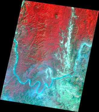
SPOT image of the study area acquired on 18 Feb 1998. Digital Elevation Model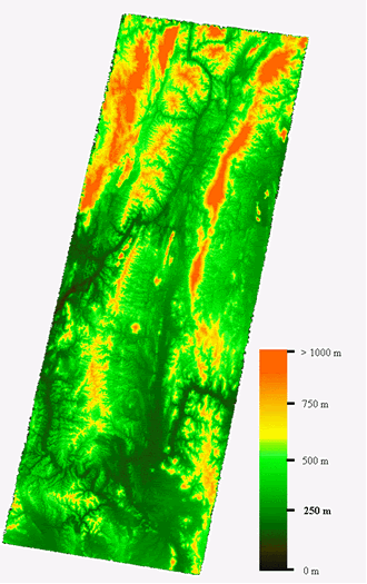 The digital elevation model (DEM) of the study area was generated from the SPOT Panchromatic stereopairs. The multispectral images were then orthorectified, based on the DEM extracted. Orthoimages acquired during the same day were mosaicked together, and atmospheric correction was done afterwards. The Slope image was computed from the DEM. Change DetectionUnsupervised change detection was carried out to identify locations of rapid environmental degradation. Two methods of change detection were used in this study. The Normalized Difference Vegetation Index (NDVI) images were generated from the multispectral images and land cover changes were identified by thresholding the difference of two NDVI images acquired at different dates. Changes in river channel were detected by performing unsupervised ISODATA classification on the multispectral images. The thematic change map for the land cover and river channel was then generated from the results of the two change detection analyses. |
||
Results
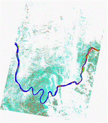
Two significant changes between 1996 and 1998 have been observed from the analysis: depletion of vegetation on both gentle and steep slopes, and increased sedimentation manifested by growth of old bars and building-up of new bars in the river channel. The vegetation in this area has been depleted in 1998 compared to 1996. In addition, a large proportion (24.2%) of the cleared land has steep to very steep slopes of more than 25 degrees, which is vulnerable to erosion and sediment transfer during the wet monsoon periods. The eroded materials will eventually reach the Mekong river channel. In the river channels, the area of the bars has increased by 66.3% in 1998, compared to 1996. It is clear that a very large volume of sediment is accumulating in the channel. The results of this study illustrate the feasibility of using satellite imagery and digital image processing/analysis techniques in rapid evaluation of environmental changes in a large river system. |
