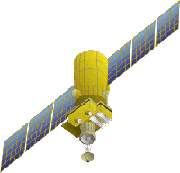
RESURS-O is a series of satellites for monitoring natural resources, similar
in function to the US LANDSAT series. Operation of the RESURS-O1 series was
started in 1985 with the launch of the RESURS-O1-1 followed by two other satellites,
the latest of which was launch in November 1994. Data is received at the ground
stations in Moscow, Novosibirsk and Khabarovsk. Recently, the data is also downlinked
straight from the satellite to the Esrange ground station in northern Sweden.
It is now possible to obtain RESURS-O imagery from the Swish Space Corporation
(SSC) Satellitbild.
RESURS-O1 Orbit
| Type |
Sun-Synchronous |
| Altitude |
678 km |
| Inclination |
98.04 deg |
| Period |
98 min |
| Repeat Cycle |
21 days (4 days revisit at Equator) |
Sensors
- MSU-SK (Multispectral Scanner of Moderate Resolution with Conical Scanning).
The MSU-SK is a wide-swath, medium resolution instrument with a conical scan.
Two visible and two near-infrared bands are acquired at a resolution of 170
m and resampled into a square grid of 160 m. The fifth band is a thermal band
with a resolution of 600 m.
MSU-SK Sensor Characteristics
| | Band |
Wavelength (µm) |
Pixel Size (m) |
|---|
| 1 |
0.5 - 0.6 (green) |
160 |
|---|
| 2 |
0.6 - 0.7 (red) |
160 |
|---|
| 3
| 0.7 - 0.8 (near IR) |
160 |
|---|
| 4
| 0.8 - 1.1 (near IR) |
160 |
|---|
| 5
| 10.4 - 12.6 (thermal IR) |
600 |
|---|
- MSU-E (High Resolution Multispectral Scanner with Electronic Scanning).
The MSU-E is a narrow swath instrument (45 km) with 45 x 35 m resolution and
3 spectral bands (0.5 - 0.6 µm, 0.6 - 0.7 µm and 0.8 - 0.9 µm).
 Back to Main
Index Back to Main
Index
|


 RESURS, Russia/CIS