|
The aim of this study is to use
multitemporal synthetic aperture radar (SAR) images in delineating
and mapping areas under different rice cropping systems in the Mekong
river delta, Vietnam. This project is a collaboration between CRISP,
the International Rice Research Institute (IRRI), Philippines and
the University of Can Tho, Vietnam. Rice cultivation in the Mekong river delta is largely governed by hydrology, rainfall pattern and the availability of irrigation. Given the diversity of the cropping systems, it would be very difficult, if not impossible, to discriminate the areas under different planting systems using one single-date image. Multi-temporal images are required to monitor the spatial and temporal growth patterns of the rice crops and subsequently to identify the cropping systems practiced at a particular region. Multispectral visible/near infrared images such as those from the SPOT or LANDSAT satellites could be used for this purpose. Unfortunately, a large part of the rice growing season coincides with the rainy period resulting in limited availability of cloud-free images throughout the growing season. The use of cloud penetrating SAR would overcome this problem. Study Area
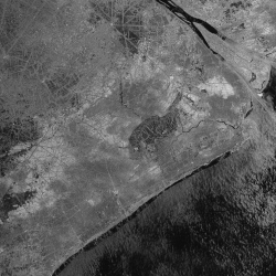
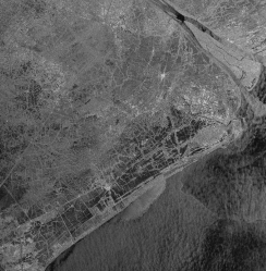
The study was confined within a 100 km by 100 km area covered by one ERS-2 SAR scene, (track 75, frame 3411 shifted 30% along track) which includes parts of Soc Trang and Bac Lieu provinces in the Mekong river delta, Vietnam. Multitemporal ERS SAR Images (1996)Seven descending mode ERS-2 synthetic aperture radar images at 35-day repeat intervals acquired on May 5, Jun 9, Jul 14, Aug 18, Sep 22, Oct 27 and Dec 1, 1996 were used in the study to delineate and classify rice cropping systems in the study area.
|
||||||||
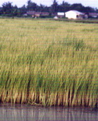
Rice Crop Monitoring Using Synthetic Aperture RadarRice crops go through distinct growth stages within a given planting season. The growth duration ranges from 3 to 6 months, depending on the variety and the environment. The radar backscatter is strongly correlated with the rice growth stages. Hence, multitemporal SAR is a very appropriate technique for monitoring rice crops.Rice crop growth stages
Radar Backscattering Signatures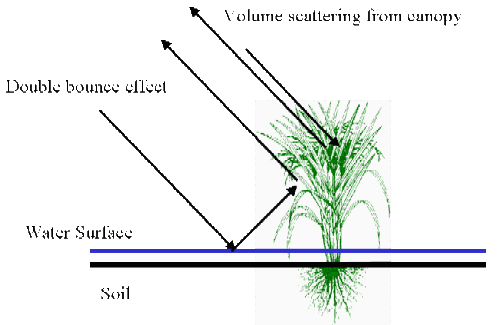
Radar backscattering from rice crops consists of the following components:
Generally, the time variation of radar backscatter follows the following sequence during a rice season:
Non-rice vegetation can be identified by their relatively time-invariant backscatter 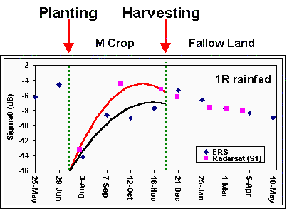
Typical backscatter time series for single cropped rice 
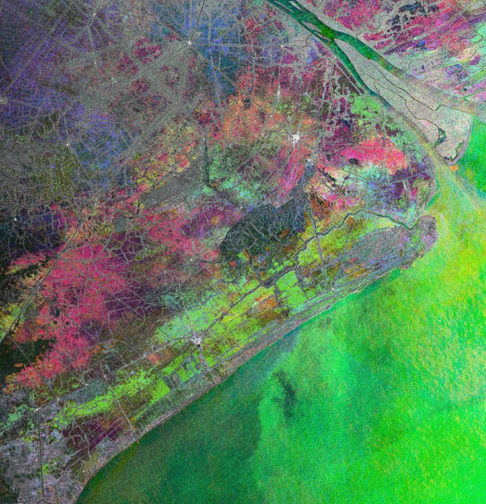
Typical backscatter time series for double cropped rice Classification of Rice Cropping SystemsA thematic map of rice cropping system was derived using a classification method based on the analysis of the temporal change patterns of the radar backscattering coefficients in the seven SAR images.
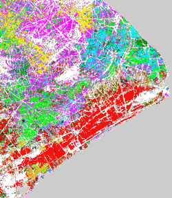  Classification |
||||||||