 |
 |
 Spaceborne Remote Sensing
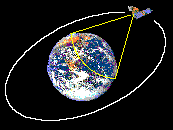
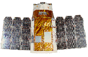
The receiving ground station at CRISP receives data from these satellites In spaceborne remote sensing, sensors are mounted on-board a spacecraft (space shuttle or satellite) orbiting the earth. At present, there are several remote sensing satellites providing imagery for research and operational applications. Spaceborne remote sensing provides the following advantages:
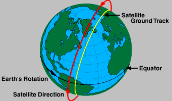
Satellite imagery has a generally lower resolution compared to aerial photography. However, very high resolution imagery (up to 1-m resolution) is now commercially available to civilian users with the successful launch of the IKONOS-2 satellite in September 24, 1999. Satellite OrbitsA satellite follows a generally elliptical orbit around the earth. The time taken to complete one revolution of the orbit is called the orbital period. The satellite traces out a path on the earth surface, called its ground track, as it moves across the sky. As the earth below is rotating, the satellite traces out a different path on the ground in each subsequent cycle. Remote sensing satellites are often launched into special orbits such that the satellite repeats its path after a fixed time interval. This time interval is called the repeat cycle of the satellite.Geostationary Orbits Geostationary Orbit: The satellite appears stationary with respect to the Earth's surface. If a satellite follows an orbit parallel to the equator in the same direction as the earth's rotation and with the same period of 24 hours, the satellite will appear stationary with respect to the earth surface. This orbit is a geostationary orbit. Satellites in the geostationary orbits are located at a high altitude of 36,000 km. These orbits enable a satellite to always view the same area on the earth. A large area of the earth can also be covered by the satellite. The geostationary orbits are commonly used by meteorological satellites. Near Polar OrbitsA near polar orbit is one with the orbital plane inclined at a small angle with respect to the earth's rotation axis. A satellite following a properly designed near polar orbit passes close to the poles and is able to cover nearly the whole earth surface in a repeat cycle.Sun Synchronous Orbits
Earth observation satellites usually follow the sun synchronousorbits. A sun synchronous orbit is a nearpolar orbit whose altitude is such that the satellite will alwayspass over a location at a given latitude at the same local solartime. In this way, the same solarillumination condition (except for seasonal variation) can be achieved for the images of a given location taken by the satellite. Remote Sensing SatellitesSeveral remote sensing satellites are currently available, providing imagery suitable for various types of applications. Each of these satellite-sensor platform is characterised by the wavelength bands employed in image acquisition, spatial resolution of the sensor, the coverage area and the temporal coverge, i.e. how frequent a given location on the earth surface can be imaged by the imaging system.In terms of the spatial resolution, the satellite imaging systems can be classified into:
In terms of the spectral regions used in data acquisition, the satellite imaging systems can be classified into:
Optical/thermal imaging systems can be classified according to the number of spectral bands used:
Synthetic aperture radar imaging systems can be classified according to the combination of frequency bands and polarization modes used in data acquisition, e.g.:
Descriptions of some of the operational and planned remote sensing sattelite platforms and sensors are provided in the appendix of this tutorial.

 Digital Images Digital Images
 Go to Main Index Go to Main Index
|


